

Importance of Site Surveys & Drone Mapping for Accurate Solar Installation
1. The Foundation: Why Precision Surveys are Non-Negotiable
A solar power plant is a 25-year investment. Its success depends entirely on the accuracy of the initial site assessment. Our process eliminates guesswork by focusing on three critical pillars:
-
Structural Integrity: We evaluate the roof's material, slope, and load-bearing capacity to ensure it can safely support the mounting structures during high winds or seismic activity.
-
Shadow Management: Even minor shading from a water tank or parapet wall can disproportionately drop energy yield. We map every obstacle—from lift rooms to HVAC units—with millimeter precision.
-
Logistical Optimization: Surveys allow us to map out the most efficient cable routing and inverter placement, reducing voltage drop and material waste.
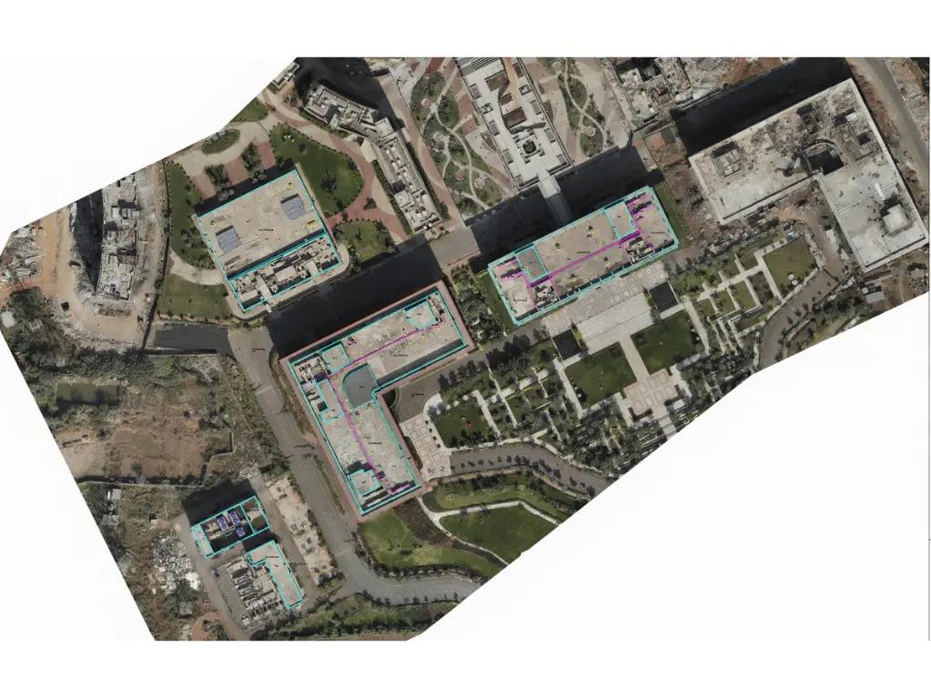
2. The Drone Advantage: High-Resolution Site Intelligence
Traditional tape-measure surveys are prone to human error, especially on multi-level or irregular rooftops. ARS SolarTech integrates Drone-Based Solar Surveying to capture a comprehensive digital twin of your property.
Key Technological Benefits:
-
Photogrammetry & 3D Modeling: Drones capture high-resolution images that are processed into 3D models. This allows our engineers to simulate the sun’s path across the roof for every day of the year.
-
Topographical Accuracy: We identify height variances and irregular boundaries that are invisible from the ground, ensuring the mounting structures are perfectly leveled.
-
Safety & Speed: Drones can survey high-rise or fragile roofs in minutes, eliminating the need for technicians to climb into hazardous areas before the site is secured.
3. From Data to Design: The Engineering Workflow
Once the drone data is processed, it moves into our advanced engineering phase. This digital-first approach ensures that the "As-Built" reality matches the "As-Designed" blueprint.
| Feature | Traditional Manual Survey | ARS Drone-Based Survey |
| Measurement Accuracy | Approx. 90-95% | 99% + |
| Shading Analysis | Estimated based on photos | Calculated via 3D Shadow Sim |
| Speed | 2–4 hours per site | 15–30 minutes per site |
| Complex Roofs | Difficult/Inaccurate | Effortless & Detailed |
4. Why ARS Solartech Leads the Field
We don’t just use drones for the sake of technology; we use them to fuel better Structural Engineering. Our commitment to innovation results in:
-
Optimized Load Distribution: Structures designed specifically for your roof's health.
-
Maximum Energy Yield: Near-zero shading losses through intelligent panel placement.
-
Reduced Project Risk: No "surprises" during installation, leading to faster execution and zero rework.
Conclusion: Data-Driven Sustainability
Precision surveying is the bridge between a "standard" solar setup and a high-performance energy asset. By merging drone mapping with deep engineering expertise, ARS SolarTech ensures that your transition to clean energy is safe, efficient, and mathematically optimized for the highest possible ROI.